The PLI01 LiDar and the PM320 Dual-Channel Anti-jamming System are not direct competitors: the PLI01 is an airborne lidar payload for collecting high-precision point cloud and imagery, while the PM320 is a navigation protection unit that shields a UAV's satellite positioning from jamming and spoofing. For training and education buyers, the comparison comes down to curriculum focus. If your program teaches surveying, mapping, forestry, or geospatial data workflows, the PLI01 is the relevant system. If your program covers navigation resilience, electronic protection, or operating in contested signal environments, the PM320 is the better fit. This article compares both using only the published product data and flags clearly where specifications are not available.
What Each System Is Designed to Do
The PLI01 LiDar, manufactured by GDU-Tech Co., Ltd., is a lightweight professional payload developed for multi-rotor platforms. It integrates a light and compact lidar system, an inertial navigation system, a control system, and a high-resolution mapping camera in a single unit. According to the product data, it efficiently collects high-precision point cloud data and rich image information, and is used for acquiring three-dimensional spatial information in surveying and mapping, electric power, forestry, agriculture, land planning, geological disasters, and mine safety.
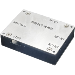
The PM320 Dual-Channel Anti-jamming System, from Guangzhou Haige Jingwei Information Industry Co., Ltd., is an ultra-miniaturized two-channel satellite navigation anti-jamming system designed for small and micro unmanned platforms. It integrates RF components, anti-jamming modules, and a receiver. It supports B1/B3 dual-frequency signal reception, provides anti-suppression jamming on the B3 frequency point (customizable), and includes anti-spoofing capability to keep user terminals operating reliably in various environments. Its compact size, low power consumption, and lightweight design make it suitable for small and micro UAV platforms and other miniaturized platforms.
Side-by-Side Comparison
The table below compares only attributes that appear in the supplied product data. Where a detail is not published, the table says so explicitly rather than estimating.
| Attribute | PLI01 LiDar | PM320 Dual-Channel Anti-jamming System |
|---|---|---|
| Category | Sensors | Sensors |
| Brand | GDU-Tech Co., Ltd. | Guangzhou Haige Jingwei Information Industry Co., Ltd. |
| Model | PLI01 | PM320 |
| Primary function | High-precision point cloud and image data collection | Satellite navigation anti-jamming and anti-spoofing |
| Designed platform | Multi-rotor UAV platforms | Small/micro unmanned platforms and other miniaturized platforms |
| Integrated components | Lidar system, inertial navigation system, control system, high-resolution mapping camera | RF components, anti-jamming modules, receiver |
| Frequency support | Not stated in available data; contact us for the datasheet | B1/B3 dual-frequency reception |
| Anti-jamming details | Not applicable to stated function | Anti-suppression jamming on B3 frequency point (customizable) |
| Anti-spoofing | Not stated in available data; contact us for the datasheet | Yes, per product description |
| Size, weight, power figures | Not stated in available data; contact us for the datasheet | Described as compact, low power consumption, lightweight; exact figures not published — contact us for the datasheet |
| Certifications and pricing | Not stated in available data; contact us for the datasheet | Not stated in available data; contact us for the datasheet |
PLI01 LiDar in a Training and Education Context
For institutions building hands-on curricula in geospatial disciplines, the PLI01's integrated design is the main practical advantage. Because lidar, inertial navigation, control, and imaging are combined in one payload, students and trainees work with a complete airborne mapping workflow rather than assembling separate subsystems. The listed application areas — surveying and mapping, electric power, forestry, agriculture, land planning, geological disasters, and mine safety — map well onto training scenarios common in Southern Africa, such as mine safety monitoring, powerline corridor surveys, and land planning exercises.
Because the payload is developed for multi-rotor platforms, it suits programs that already operate multi-rotor training aircraft. Note that the supplied data does not specify which multi-rotor platforms it supports, its weight, its accuracy figures, or its software requirements — contact us for the datasheet before committing to an airframe integration.
PM320 in a Training and Education Context
The PM320 addresses a different teaching objective: keeping navigation reliable when satellite signals are degraded. For programs covering UAV operations in challenging environments, GNSS fundamentals, or electronic protection awareness, an anti-jamming system gives trainees a concrete example of how signal suppression and spoofing are countered at the receiver level. Its B1/B3 dual-frequency reception and anti-spoofing capability are the specific technical features published in the data.
The product description emphasizes ultra-miniaturization, low power consumption, and light weight, which the manufacturer positions as especially suitable for small and micro UAV platforms. For a training fleet built around small airframes, this is relevant, but exact dimensions, power draw, and weight are not published — contact us for the datasheet to confirm compatibility with your aircraft.
Key Differences That Affect Procurement
- Function: the PLI01 collects 3D spatial data and imagery; the PM320 protects satellite navigation signals. They can serve the same platform but not the same mission.
- Payload role: the PLI01 is a mission payload that produces deliverable data; the PM320 is an enabling subsystem that supports flight reliability.
- Platform focus: the PLI01 is described for multi-rotor platforms; the PM320 targets small and micro UAV platforms and other miniaturized platforms.
- Customization: the PM320's B3 anti-jamming is noted as customizable; no customization options are stated for the PLI01 in the available data.
- Data availability: neither product publishes detailed specifications, certifications, or pricing in the supplied data. Request datasheets from both vendors before evaluation.
What the Published Data Does Not Cover
Procurement teams should be aware of the limits of the available information. For the PLI01, the data does not include point cloud accuracy, scan specifications, camera resolution, weight, power consumption, supported software, or compatible airframe models — contact us for the datasheet. For the PM320, the data does not include jamming resistance performance figures, physical dimensions, interface details, power figures, or certifications — contact us for the datasheet. Neither dataset includes pricing, lead times, warranty terms, or regional support arrangements, including availability in Southern Africa. Treat any figure not listed above as unverified until confirmed by the manufacturer.
Selection Guidance: Choosing by Mission Fit
Base your decision on the mission your training or operational program must support, not on generic capability claims:
- Choose the PLI01 LiDar if your program's outcome is producing high-precision point cloud data and imagery for surveying, mapping, forestry, agriculture, powerline inspection, land planning, geological disaster assessment, or mine safety work.
- Choose the PM320 if your program's outcome is reliable satellite navigation in environments where jamming or spoofing is a concern, or if you teach navigation resilience as part of UAV operations training.
- If both outcomes matter, the systems are complementary rather than alternatives: a multi-rotor platform could, in principle, carry the PLI01 for data collection while the PM320 protects its navigation — subject to payload, integration, and compatibility details you should confirm via datasheets.
- For small or micro UAV fleets, the PM320's stated design focus on miniaturized platforms is the documented fit; verify the PLI01's platform compatibility separately.
- For buyers in Southern Africa, align the choice with regional training priorities — mine safety and land-related surveying are explicitly listed PLI01 applications — and request datasheets to confirm export, support, and integration details for your region.
In short: match the system to the mission. The PLI01 answers the question "how do we capture accurate 3D data from a multi-rotor UAV?" The PM320 answers "how do we keep navigation working when signals are under attack?" Define which question your program needs to answer first, then request the datasheets to validate the technical fit.

Featured product
PLI01 LiDar
PLI01 lidar is a lightweight professional equipment developed for multi-rotor platforms. It integrates light and compact lidar systems, inertial navigation systems, control systems and high-resolution mapping cameras. It can efficiently collect high-precision point cloud data and rich image information, It is widely...
Products mentioned in this guide
PM320 Dual-Channel Anti-jamming System
"n ultra-miniaturized 2-channel satellite navigation anti-jamming system designed for small/micro unmanned platforms. It integrates RF components, anti-jamming modules, and a...
View product details →
HS 77G 20M MMW
HS 77G MMW is a 77GHz band short-range medium-low speed obstacle avoidance radar, which transmits cone-shaped electromagnetic waves to the front, detects the reflection of...
View product details →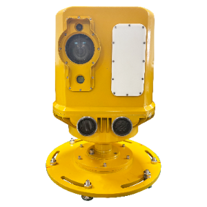
High-Precision Airport Runway Foreign Object Debris (FOD) Intelligent Detection System
The system primarily utilizes FMCW millimeter-wave radar detection technology and high-resolution optical image processing technology, with dual-sensor hybrid synchronous...
View product details →Frequently asked questions
Are the PLI01 LiDar and the PM320 anti-jamming system competing products?
No. The PLI01 is a lidar payload that collects high-precision point cloud data and imagery for mapping and surveying applications. The PM320 is a satellite navigation anti-jamming system that protects positioning signals from suppression jamming and spoofing. They serve different functions and can be complementary rather than alternatives.
Which UAV platforms does each product support?
The PLI01 is described as developed for multi-rotor platforms; specific compatible airframe models are not listed in the available data — contact us for the datasheet. The PM320 is designed for small and micro unmanned platforms and can also be applied to other miniaturized platforms.
What specifications are available for the PLI01 and PM320?
The published data covers each product's function, integrated components, and intended platforms. Detailed figures such as weight, dimensions, power consumption, accuracy, jamming resistance performance, and interface specifications are not included — contact us for the datasheets.
Do these products have published certifications or prices?
No. Certifications and pricing are not included in the supplied data for either product. Contact us for the datasheet and vendor quotations before including either system in a procurement shortlist.
Which system is better for a training and education program in Southern Africa?
It depends on your curriculum. If the program teaches surveying, mapping, forestry, agriculture, land planning, geological disaster assessment, or mine safety — application areas explicitly listed for the PLI01 — the lidar payload is the relevant choice. If the program covers navigation resilience and operating in jamming or spoofing environments, the PM320 fits. For regional procurement, request datasheets to confirm integration and support details.
Need help selecting the right system?
Tell us your mission, payload, and operating environment. Our team will help you compare options and request the right datasheets from verified suppliers.