Sensors for mining and stockpile measurement are the components that turn a UAV flight into a trustworthy volumetric survey: the inertial measurement unit (IMU) stabilizes and orients the platform, the positioning chain delivers accurate georeferencing, and anti-interference systems keep that positioning usable in electromagnetically noisy sites. For procurement teams specifying drones or retrofitting survey payloads for open-pit operations, the practical question is which sensor combination will hold its accuracy in dust, heat, and congested radio environments, and how easily it will integrate with existing flight control and photogrammetry workflows. This article walks through that workflow, the integration and operating constraints to plan for, training requirements, and the questions to put to suppliers before you buy.
Why Sensor Selection Decides Survey Quality in Mining
Stockpile measurement depends on every image or LiDAR return being tagged with an accurate position and orientation. If the platform's attitude estimate drifts or its positioning degrades mid-flight, the resulting point cloud is distorted and volume calculations inherit that error. That is why experienced survey leads treat the sensor suite, not the airframe, as the core of a mining measurement system.
Three sensor categories carry most of the load in a typical UAV survey setup:
- Inertial measurement units (IMUs) measure angular velocity and acceleration, providing the attitude data that keeps the camera or scanner pointed correctly and stabilizes the platform.
- RTK GNSS modules provide centimeter-level positioning and high-precision heading data, which is what turns imagery into a georeferenced survey product.
- GNSS anti-interference systems protect positioning and timing in environments where broadband interference can otherwise degrade or deny satellite reception.
The Stockpile Measurement Workflow, Step by Step
A typical UAV stockpile survey follows a repeating cycle: plan the flight grid over the stockyard or pit, fly the mission at a consistent altitude and overlap, capture imagery or scan data, georeference it, and process it into volume reports for reconciliation and planning. Sensors affect every stage of that cycle.
- Flight planning: heading accuracy from the positioning chain determines whether straight, evenly spaced grid lines are flown as planned.
- Data capture: the IMU's attitude solution keeps the sensor stable and level, which directly affects image overlap quality and point cloud consistency.
- Georeferencing: centimeter-level positioning from an RTK module reduces or removes the need for extensive ground control points, shortening site time.
- Processing: consistent orientation and position data across flights means volumes from successive surveys can be compared reliably for month-over-month reconciliation.
For teams building or upgrading this chain, the High-performance Inertial Measurement Unit (BW-IMU600, Wuxi BEWIS Sensing Technology LLC) is one example of a MEMS-based IMU designed for integration into such systems. It uses highly reliable MEMS accelerometers and gyroscopes with algorithm-based accuracy assurance, and applies non-linear, quadrature, temperature, and drift compensation to reduce error sources. Its sealed design and strict production process are intended to keep angular velocity and acceleration measurements accurate in harsh environments, which is relevant to dusty mine sites. It is one option among several; other IMU and gyroscope products on the marketplace may suit different accuracy or budget requirements.
Integration Considerations for UAV and Survey Teams
Integration is where sensor projects succeed or stall. Before ordering, confirm how each sensor connects to your flight controller, payload computer, or data logger, and who on your team will do the integration work.
- Interface type: the BW-IMU600 provides a digital interface, which the manufacturer notes allows convenient integration into a user's system. Confirm the specific protocol and connector against your flight controller's documentation; contact us for the datasheet.
- Positioning architecture: the HD-RTK-UM982 RTK module from Suzhou HardAus Equipment Technology Co., Ltd. is developed on the UM982 chip and supports mobile carriers including UAVs, unmanned ground vehicles, and surveying equipment. It can be used flexibly as either a rover station or base station, which matters if you want one hardware type for both the aircraft and a ground reference.
- Stabilization needs: if your payload includes an electro-optical pod or requires platform stabilization, a single-axis fiber optic gyroscope such as the HR-150 from Zhejiang Rainbow Aerospace Measurement & Control Technology Co., Ltd. measures angular velocity along its sensitive axis and is described as suitable for electro-optical pods, strapdown inertial navigation, inertial measurement systems, and optical platform stabilization, with compact size, light weight, wide measurement range, and fast data refresh rates.
- Power and wiring: confirm supply voltage and power draw for every added sensor. The WL669 anti-interference system, for example, is powered by +5V and includes antenna, RF, processing components, and receiver.
Operating Constraints: Dust, Heat, and Interference
Mining sites are among the most demanding RF and physical environments a survey UAV will encounter. Haul trucks, crushers, and site communications infrastructure generate electromagnetic noise; blasting schedules and dust exposure add physical stress. For operations in West Africa, where large open-pit sites often combine remote logistics with dense radio traffic around processing facilities, these constraints deserve explicit attention in your specification.
On the positioning side, the WL669 four-channel GNSS anti-interference system from SHENZHEN STARS TECHNOLOGY CO.,LTD processes 4-channel BDS_B1/GPS_L1 signals and can resist 3 broadband interferences to maintain high-precision positioning and timing under strong interference. If your site hosts multiple radio systems or you operate near other GNSS-dependent equipment, this category of protection is worth evaluating.
On the inertial side, look for sealed construction and documented compensation methods. The BW-IMU600's sealed design and compensation approach (non-linear, quadrature, temperature, and drift compensation) are aimed at maintaining measurement accuracy in harsh environments, but you should always request the datasheet to confirm the operating temperature range, shock and vibration limits, and accuracy figures against your site conditions rather than assuming suitability.
Comparing Sensor Options in the Chain
The table below summarizes the roles of the sensor types covered here. These are complementary components in a measurement chain rather than direct substitutes for one another.
| Attribute | BW-IMU600 (IMU) | HD-RTK-UM982 (RTK module) | WL669 (anti-interference) |
|---|---|---|---|
| Primary role | Measures angular velocity, acceleration, and motion parameters | Centimeter-level positioning and high-precision heading | Protects positioning and timing under interference |
| Technology | MEMS accelerometers and gyroscopes with compensation algorithms | UM982 chip-based GNSS | 4-channel BDS_B1/GPS_L1 processing |
| Notable design features | Sealed design; digital interface; non-linear, quadrature, temperature, and drift compensation | Rover or base station operation; supports UAVs, UGVs, surveying equipment | Integrated antenna, RF, processing, and receiver; +5V power; resists 3 broadband interferences |
| Typical fit | Attitude sensing and stabilization in the flight control chain | Georeferencing for survey deliverables | Sites with significant RF interference |
If your payload also requires a dedicated stabilization gyro, the HR-150 single-axis fiber optic gyroscope fills that role separately; contact us for the datasheet to compare its measurement range and refresh rate against your pod or gimbal requirements.
Training and Operational Readiness
Sensors do not eliminate the need for trained operators. A capable survey crew should cover:
- Mission planning and flight execution for consistent grid coverage over stockpiles and pit benches.
- RTK setup, including configuring the module as a rover or base station and understanding when a base station is needed on site.
- Sensor health checks: verifying IMU output, positioning status, and interference alerts before each survey flight.
- Data QA: recognizing when attitude or positioning anomalies have compromised a dataset, so a flight can be reflown rather than delivering unreliable volumes.
Budget for this training when comparing total cost of ownership; a sensor chain that requires specialist integration and calibration knowledge will need more qualified staff than a turnkey setup.
Procurement Questions to Ask Before You Buy
Before committing to any sensor for a mining measurement program, put these questions to the supplier and get answers in writing:
- Can you provide the full datasheet, including accuracy figures, operating temperature range, and environmental ratings? If a specification is not published, ask rather than assume.
- What is the integration path into our existing flight controller or survey system, and what documentation is provided for the digital interface?
- For RTK equipment: what is required to operate it as a base station versus a rover, and what corrections infrastructure does our site need?
- What interference conditions has the anti-interference system been designed for, and how does the 3-broadband-interference resistance translate to our site's RF environment?
- What are the lead times, warranty terms, and spare-part availability for operations in our region?
Asking these questions early prevents the most common failure mode in UAV survey procurement: a sensor chain that performs well on the bench but underdelivers in the pit. Specify the IMU, positioning, and interference protection as a matched system, verify every figure against the datasheet, and your stockpile measurement program will produce volumes your finance and planning teams can act on.

Featured product
High-performance Inertial Measurement Unit
BW-IMU600 is made in China 100%,all key chip components is made in China 100%. BW-IMU600 adopts highly reliable MEMS accelerometers and gyroscopes, and guarantees the measurement accuracy through algorithms; meanwhile, the sealed design and strict production process ensure that the product can still measure the...
Products mentioned in this guide
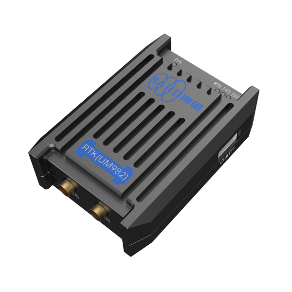
RTK Module
This product is developed based on the UM982 chip. It supports operation of mobile carriers such as UAVs, unmanned ground vehicles and surveying equipment, and can be flexibly...
View product details →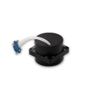
Fiber Optic Gyroscope
The HR-150 single-axis fiber optic gyroscope is a standardized low-precision closed-loop fiber optic gyroscope, primarily suitable for applications such as electro-optical pods,...
View product details →
WL669 Four-channel Global Navigation Satellite System (GNSS) Anti-interference System
The anti-interference system processes 4-channel BDS_B1/GPS_L1 signals, is powered by +5V, and includes antenna, RF, processing components and receiver. It can resist 3 broadband...
View product details →Frequently asked questions
What role does an IMU play in UAV stockpile measurement?
An IMU measures the platform's angular velocity, acceleration, and other motion parameters, providing the attitude data that keeps the camera or scanner stable and correctly oriented during survey flights. Consistent attitude data is what makes point clouds and imagery usable for accurate volume calculation.
Why is the BW-IMU600 suited to harsh mining environments?
According to the manufacturer, the BW-IMU600 uses highly reliable MEMS accelerometers and gyroscopes with algorithm-based accuracy assurance, applies non-linear, quadrature, temperature, and drift compensation to reduce error sources, and features a sealed design and strict production process intended to maintain accurate measurement in harsh environments. For detailed specifications, contact us for the datasheet.
Do I need an RTK module for stockpile surveys?
RTK positioning provides centimeter-level positioning and high-precision heading data, which is what georeferences your survey data to the accuracy stockpile volume reporting requires. The HD-RTK-UM982 supports UAVs, unmanned ground vehicles, and surveying equipment, and can operate as either a rover station or base station. Whether it is mandatory depends on your accuracy requirements; for most volumetric reconciliation workflows, high-accuracy positioning is expected.
When is a GNSS anti-interference system necessary?
If your site has significant radio traffic or equipment that can degrade satellite reception, an anti-interference system helps maintain positioning and timing. The WL669 processes 4-channel BDS_B1/GPS_L1 signals and can resist 3 broadband interferences to ensure high-precision positioning and timing under strong interference. Assess your site's RF environment before deciding.
Can these sensors be integrated into an existing UAV system?
Integration depends on interface compatibility with your flight controller or payload computer. The BW-IMU600 has a digital interface designed for convenient integration into a user's system, and the WL669 integrates antenna, RF, processing components, and receiver in one unit powered by +5V. Request datasheets and interface documentation from the supplier before purchase to confirm compatibility with your specific system.
Need help selecting the right system?
Tell us your mission, payload, and operating environment. Our team will help you compare options and request the right datasheets from verified suppliers.