Robot specifications explained simply: for logistics and delivery buyers, the numbers that matter most on a measurement robot are scan range, point cloud density, registration accuracy, and the level of automation in data stitching. These four specifications determine whether a robot can produce a usable millimeter-level digital model of a warehouse, distribution center, or delivery hub — and how many operator hours that model will cost you. This guide breaks down what each specification means in practice, how it affects mission fit, and what to ask suppliers before committing to a purchase.
Why Specification Literacy Matters in Logistics Procurement
Logistics operations increasingly depend on accurate digital models of physical spaces. Reverse modeling of architectural spaces supports facility planning, storage layout optimization, clearance verification for automated equipment, and documentation of existing infrastructure. When the underlying measurement is imprecise, every downstream decision inherits that error. This is why procurement teams evaluating a measurement robot should read specifications not as marketing figures but as operational constraints: a stated scan range tells you how many positions you must occupy to cover a space, and a stated accuracy level tells you whether the resulting model can support engineering-grade decisions.
The Riemann precision measurement robot, produced by UING Intelligence Technology (Shenzhen) Co., Ltd., is a high-precision millimeter-level surveying robot designed specifically for reverse modeling of architectural spaces. It is a domestically produced alternative with 100% independent intellectual property rights, which is relevant for buyers concerned with supply chain provenance and long-term support.
Scan Range: What 360°x355° Means in Practice
Scan range defines the angular coverage a sensor achieves from a single position. The Riemann features what the manufacturer describes as the first near full space scanning range of 360°x355°. In practical terms, horizontal coverage of 360° means the sensor captures the entire surrounding environment in one rotation, while 355° vertical coverage means only a narrow band remains unscanned from a given station.
For logistics buyers, this specification translates directly into field efficiency. A wider scan range means fewer repositioning stops are needed to cover a warehouse aisle, a loading bay, or a multi-level distribution facility. Fewer stops mean less time on site, fewer opportunities for registration error between stations, and lower labor cost per surveyed square meter. When comparing robots, ask suppliers to state the effective scan range at the distances relevant to your facility — coverage figures can vary with target reflectivity and range, so request the datasheet for distance-dependent performance details.
Point Cloud Density and Registration: The Specs Behind Accuracy
A measurement robot's output is a point cloud — a set of measured points representing the surfaces of a space. Two specifications govern its usefulness:
- Point cloud density: the number of measurement points captured per unit area or volume. The Riemann supports adjustable point cloud density, meaning operators can increase density for detail-critical areas such as racking interfaces or door clearances, and reduce it for open floor areas to keep file sizes manageable. For logistics teams digitizing large facilities, this adjustability directly affects storage, processing time, and downstream software compatibility.
- Registration accuracy: how precisely scans taken from multiple positions are aligned into a single coherent model. The Riemann uses multi-position scan data point cloud precise registration combined with high-precision attitude calculation and error calibration. Poor registration shows up as doubled walls, misaligned racks, or ghost surfaces — defects that can invalidate a model used for facility planning.
Buyers should also ask about network precision data acquisition, which the Riemann supports. This refers to the control framework that ties individual scans into a consistent spatial reference. If your project requires the model to align with existing site coordinates or GIS data, confirm with the supplier how the system's network precision is established and verified — contact us for the datasheet for the detailed figures.
Automation Features: Multi-Space Stitching and Efficiency
The most operationally significant specification in the Riemann's data set is automatic multi-space stitching: the system can automatically stitch multiple spaces into a unified model. According to the manufacturer, this significantly improves measurement efficiency by several orders of magnitude compared with conventional workflows.
For a logistics operation, the difference matters at scale. A distribution center typically comprises multiple connected spaces — receiving areas, storage zones, sorting floors, and outbound bays. A workflow that requires manual alignment between each space consumes engineer hours and introduces human error. Automatic stitching compresses that post-processing stage, which is often where survey projects lose the most time. When evaluating any measurement robot, ask the supplier to describe the stitching workflow, what operator input it requires, and how the output is validated.
Mission Fit: Matching the Robot to the Logistics Use Case
Not every robotics purchase in a logistics environment is an interior measurement task. The Robot category on SkyDrone Max includes complementary platforms, and understanding where each fits prevents over- or under-specifying a purchase:
| Attribute | Riemann precision measurement robot | Hypertron T01 Wheel-Legged Robot | FS-60UC Hyperspectral Measurement System |
|---|---|---|---|
| Category | Robot | Robot | Drones |
| Brand | UING Intelligence Technology (Shenzhen) Co., Ltd. | Shenzhen Astrall Dynamics Technology Co., Ltd | CHNSpec Technology (Zhejiang) Co., Ltd |
| Primary function | Millimeter-level surveying and reverse modeling of architectural spaces | Industrial missions: inspections, rescue, patrols, surveying and mapping, heavy-load transportation | UAV-based lidar and hyperspectral imaging data acquisition |
| Key specification in data | Near full space scanning range of 360°x355°; adjustable point cloud density | High payload capacity, long-endurance battery life, all-terrain capability, full autonomy | Spectral range 400~1700nm; lidar ranging range of 300m |
| Best fit | Interior facility digitization and reverse modeling | Hazardous or repetitive outdoor/industrial tasks across rough terrain | Aerial spectral and lidar surveys of sites and surrounding areas |
A useful pattern for logistics buyers: use a dedicated measurement robot like the Riemann for high-accuracy interior modeling, and consider a platform such as the Hypertron T01 where the mission involves mobility across mixed terrain or transport of loads. Where aerial coverage of a site and its surroundings is required, a UAV-based system such as the FS-60UC — with its 300m lidar ranging range and 400~1700nm spectral range — addresses a different layer of the data requirement. Positioning accuracy across any of these systems can also depend on satellite-based positioning; UING's RTK high-precision direction finding and positioning module, based on the UM982 series, supports quad-mode RTK solution across BeiDou, GPS, Galileo, and GLONASS with a 2-second hot start time — a relevant consideration for buyers in East Africa and other regions where multi-constellation support improves solution reliability.
Questions to Ask Suppliers Before You Buy
Before committing to a measurement robot, put these questions to the supplier. They separate a specification sheet that supports your mission from one that merely sounds impressive:
- What is the verified millimeter-level accuracy, and under what conditions was it measured? The Riemann is described as millimeter-level; request the datasheet for the test conditions and verification method.
- How does the adjustable point cloud density behave at the extremes — maximum density for detail-critical areas and minimum density for large open floors — in terms of file size and processing load?
- What does automatic multi-space stitching require from the operator, and how are stitched models validated for accuracy?
- What training, software, and support are included, particularly for teams in East Africa and other regions where on-site manufacturer support may be limited?
- What are the export, licensing, and intellectual property terms? The Riemann carries 100% independent intellectual property rights, which can simplify procurement in some jurisdictions — confirm the specifics with the supplier.
Specifications are only as valuable as your ability to verify them against your own mission profile. For the Riemann precision measurement robot, the published data establishes its core capabilities: millimeter-level surveying, 360°x355° near full space scanning, precise multi-position registration, adjustable point cloud density, and automatic multi-space stitching. For any figure not covered here — including detailed accuracy tables, weight, power requirements, and software compatibility — contact us for the datasheet.

Featured product
Riemann precision measurement robot
Riemann is a high-precision millimeter-level surveying robot specifically designed for reverse modeling of architectural spaces. It is a domestically produced alternative with 100% independent intellectual property rights, featuring the first near full space scanning range of 360°x355°. It utilizes multi-position scan...
Products mentioned in this guide

HypertronT01- Wheel-Legged Robot
Hypertron T01 is engineered specifically for industrial applications, boasting advantages such as high payload capacity, long-endurance battery life, all-terrain capability, and...
View product details →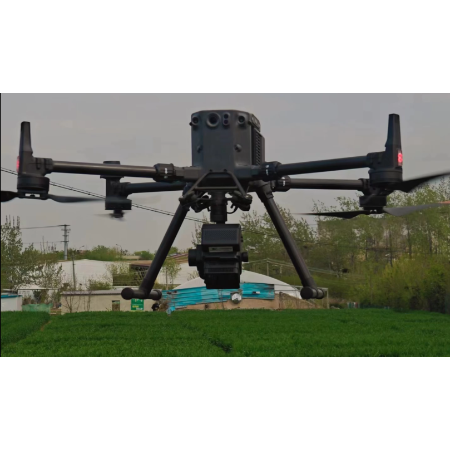
Hyperspectral Measurement System
The FS60-UCR series UAV hyperspectral lidar measurement system is a multifunctional UAV detection equipment that integrates lidar and hyperspectral imaging to obtain lidar and...
View product details →
RTK high-precision direction finding and positioning module
Key technical parameters: Based on the UM982 series products, it supports full system and full frequency point on-chip RTK positioning and dual-antenna direction solving. It also...
View product details →Frequently asked questions
What does the 360°x355° scanning range on the Riemann mean for warehouse surveys?
It means the sensor captures a full horizontal circle and 355° of vertical coverage from a single position, leaving only a narrow unscanned band. In practice, this reduces the number of repositioning stops needed to cover a warehouse or distribution center, which shortens survey time and reduces the chance of alignment errors between stations.
Why is adjustable point cloud density important for logistics buyers?
Adjustable point cloud density lets operators capture more measurement points in detail-critical areas, such as racking interfaces and door clearances, and fewer points in open areas. This controls file size and processing time, which matters when digitizing large logistics facilities.
Can the Riemann model multiple connected spaces automatically?
Yes. According to the manufacturer, the system can automatically stitch multiple spaces into a unified model, significantly improving measurement efficiency by several orders of magnitude. This is particularly relevant for distribution centers with multiple connected zones such as receiving, storage, and outbound areas.
How does the Riemann achieve its stated accuracy?
The system uses multi-position scan data point cloud precise registration, high-precision attitude calculation, and error calibration, along with network precision data acquisition technology. For the specific verified accuracy figures and test conditions, contact us for the datasheet.
Is the Riemann suitable for buyers in East Africa?
The published data describes the Riemann as a domestically produced product with 100% independent intellectual property rights, which can be relevant for procurement and support considerations. For region-specific availability, training, and support arrangements in East Africa, contact us for the datasheet and current terms.
Need help selecting the right system?
Tell us your mission, payload, and operating environment. Our team will help you compare options and request the right datasheets from verified suppliers.