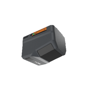
CHCNAV AlphaAir 6
Category: Mission Payload
Model: AA6
The CHCNAV AlphaAir 6 (AA6) airborne LiDAR system is designed for efficient aerial surveying in complex and high-relief terrain. Combining next-generation prism scanning technology with a high-grade inertial navigation system, the AA6 delivers a maximum ranging capability of up to 2,100 m and supports typical operating altitudes of 100–600 m AGL. Powered by 5th-generation waveform processing, it enhances point cloud density and data completeness. Its lightweight integrated design improves flight endurance, while open interfaces ensure compatibility with multirotor and fixed-wing UAV platforms.