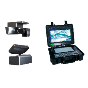
Real-time 2D/3D Reconstruction System - Airborne Unit and Ground Station
Category: Parts & Components,System Platforms
Model: GAD-SWJM
"The real-time 2D/3D reconstruction system consists of a drone platform, an airborne acquisition unit, a ground-based tracking and transmission unit, and a portable geographic information support case. It features a proprietary secure data link and automatic tracking antenna technology, supporting lossless transmission of original images. The system is equipped with a full-frame two-axis gimbal-stabilized camera, enabling real-time generation of DOM, DEM, DSM orthophotos, PLY 3D point clouds, and OSGB 3D models during flight, achieving a ""reconstructing as it flies"" real-time processing capability. To address the challenges of nighttime operations, the system incorporates F1.4 large aperture optical enhancement, a back-illuminated CMOS sensor, and a high-color-rendering-index LED flexible fill light, combined with a deep learning-based multi-scale feature enhancement algorithm. This breakthrough allows 3D reconstruction in ultra-low-light environments as dim as 0.05 lux, with a single nighttime flight covering up to 1.2 km². The system is equipped with RTK/PPK positioning and low-profile sensors, achieving surveying accuracy better than 10 cm. It provides fast, accurate, all-weather geographic information support for disaster assessment, command, and decision-making."