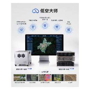
Low-Altitude Master—Integrated Low-Altitude Telemetry Product Solution
Category: System Platforms
Model: 无
Low-Altitude Master—Integrated Low-Altitude Telemetry Product Solution Low-Altitude Master is a comprehensive solution that integrates real-world 3D modeling with low-altitude UAV inspection capabilities to achieve the integration of surveying and remote sensing. It features five core capabilities—control, management, intelligence, computing, and services—enabling UAV control, equipment and data management, AI analysis, and computing power and storage scheduling and management, thereby bridging the gap between perception and application services. Leveraging Low-Altitude Master’s integrated telemetry capabilities, the solution assigns precise 3D spatial coordinates to perception data, enhancing perception capabilities with 3D spatial information to truly achieve “what you see is what you get, and what you see is where it is.”