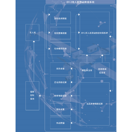
DY-2 UAV Field Data System
Category: Solutions,System Platforms
Model: DY-2
This system is primarily developed as a general-purpose GIS and target intelligence tool software, addressing the shortcomings of current GIS software in military applications. Built on a lightweight GIS framework, it integrates specialized needs for target data management and intelligence product production, resulting in a customized intelligence application system. It can meet the requirements for remote sensing image intelligence production, image and intelligence material management, intelligence information query and retrieval, and customized distribution and usage of results. The system can be embedded in a laptop or image workstation, allowing it to operate either standalone or networked.